|
| |
North Platte River
From I-80 to Casper
The North Platte is a big
river, covering lots of territory and diversity in Wyoming. There are
quite a few public access points to the river. The best way to fish this
river is by floating - most access points have put-in/take-out
capability. There is also access at several parks in Casper. Be sure to pick up a
current Wyoming fishing regulations book, or check locally for regs.
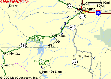
We have listed 13 access points for you here. All are identified by number on the
map at the bottom of
this page.
Get fishing conditions
and stream flows on our reports page.
Key:
- Fish: B,
R, C, W for Browns, Rainbows,
Cutthroats, Walleye
- Facilities: T, Camp, Boat
Ramp
for Toilets, Camping, Boat Ramp or access
- Number (1)
corresponds to location on map
|
Robertson Road (1)
- Go southwest 6 miles from Casper on WY 220; turn
onto Robertson Road and travel 1/3 mile
- Fish:
R, C, B
- Facilities: none
| |
Bessemer Bend (2)
- Go southwest from Casper on WY 220
for 11 miles; look for sign; turn northwest onto Bessemer Road (Cnty 308) and
travel 2.0 miles
- Fish: B,
R, C
- Facilities: T, Wildlife
viewing, Boat Ramp
|  |
Paradise Valley (2)
- Go southwest from Casper on WY 220
for 11 miles; turn northwest onto Bessemer Road (Cnty 308) and
travel 2.8 miles. Dirt parking lot next to river
- Fish: B,
R, C
- Facilities: none
|
Government Bridge (4)
- Go southwest from Casper on WY 220
for 22 miles; signed
- Access also on west side of
river, north from bridge; no dogs allowed March 15 to May 1
- Fish: C,
B, R
- Facilities: none
|  |
Bolten Creek (5)
- Go southwest from Casper on WY 220
for 21 miles; turn southeast onto Bolten Creek Road (Cnty 404) and
follow to N. Platte River
- Fish: B,
R, C
- Facilities: T, Boat Ramp
|
Lusby (5)
- Go southwest from Casper on WY 220
for 24 miles; turn south onto signed WG&F Rd and follow to N. Platte River
- Fish: B,
R, C
- Facilities: T, Boat Ramp
|  |
Walk-In Access (5)
- Go southwest from Casper on WY 220
for 26 miles; park on south side of road. Look for WG&F signs.
Access is on south shore only by wading across river or floating and
stopping.
- Fish: B,
R, C
- Facilities: None
| |
Grey Reef (55)
- Go southwest from Casper on WY 220
for 29 miles; turn east onto Cnty 412 and
follow to N. Platte River
- Fish: B,
R, C
- Facilities: T, Camp,
Boat Ramp
- Story
and photos
|  |
Above Grey Reef (56)
- Go southwest from Casper on WY 220
for about 30 miles; turn southeast just below Alcova Dam; parking
and access on north side of road
- Fish: B,
R, C
- Facilities: None
|
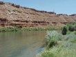 |
Fremont Canyon (57)
- Go southwest from Casper on WY 220
for about 45 miles; located 4 miles below Pathfinder Dam; very
scenic
- Fish: B,
R, C
- Facilities: T
-
Info from Bureau of Rec
|
|
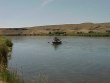
Miracle Mile (6)
- This well-known area lies between
the Seminoe and Pathfinder Reservoirs. You can get more information
on these areas from links on the Lakes and
Reservoirs page
- Go north from Sinclair on Cnty Rd
352 for 45 miles. OR
- Go southwest from Casper on WY 220
to Alcova; turn south on Cnty Rd 407; turn west on Cnty Rd 351 to N.
Platte River
- Fish: B,
R, C, W
- Facilities: T, Camp
- Story and Photos
about fishing the "Mile"
|
 |
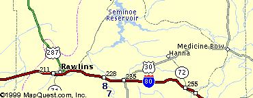
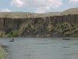
Ft. Steele/Rochelle (7)
- At Ft. Steele exit off I-80, 15
miles east of Rawlins. Follow S. frontage road east to river; river
access for about 11 miles
- Fish: B,
R, C, W
- Facilities: T
- More info on
Ft.
Steele State Historic site
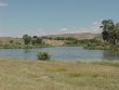
|
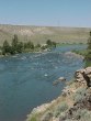
North Platte near Ft. Steele. Photo Courtesy Jack
Olson
|
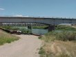
Interstate Bridge (8)
- At the Ft. Steele exit off I-80, 15
miles east of Rawlins
- Fish: B,
R, C, W
- Facilities: Camp,
Boat Ramp
|
|